Article continues below

(Credit: Mike MacEacheran)
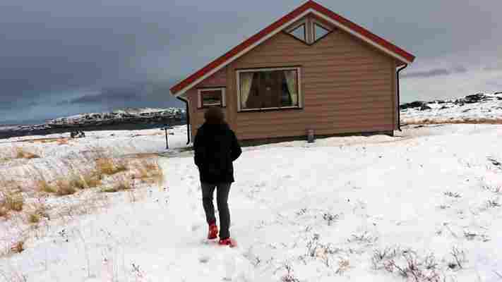
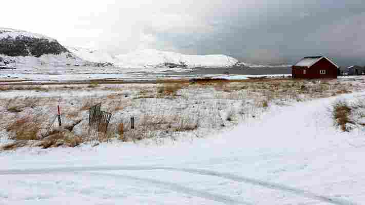
Not long after Ingunn Utsi had created a fresh set of footprints to her cabin, snow began to fall across the top of the world. It covered her car in a downy layer of white and erased the faint track connecting her oceanfront cabin outside Repvåg, in northern Finnmark, to the E69, a ribbon of ice-covered tarmac at the ends of the Earth.
As the light faded to a bleak glimmer, the 69-year-old Sami artist peered out the window, seeing her connection to the outside world vanish.

(Credit: Mike MacEacheran)
There was a time when I was growing up when there were no roads here. Only boats. Life moved much slower then," Utsi said.

(Credit: Mike MacEacheran)
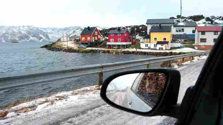
Running 129km north from Olderfjord to Nordkapp on a finger of land at the top of Arctic Norway, the E69 is the world’s most northerly highway, a marvel of engineering along the coast of Western Europe’s northernmost peninsula. First proposed as early as 1908 by Landslaget for Reiselivet i Norge (the country’s fledgling national tourist association), yet only completed in 1999, the road is a brilliant contradiction, connecting a handful of remote and fragile fishing communities that have long proven they are capable of living without the outside world. For many, wooden boats continue to satisfy their needs.
To drive the road today is to glimpse Norway’s wilderness at its rawest. Obsidian-black bluffs rise up over narrow sea inlets; mountains lurch into the windshield before giving way to vast plateaus pockmarked by dwarf birch; and violent storms frequently roll in from the intimidating Barents Sea. Come winter, the last stretch to Nordkapp and the abrupt cliffs of Knivskjellodden, Europe’s fabled northernmost point, becomes nearly impassable, only open for convoy driving. Without the highway, it’s easy for a first-time visitor to think that the villages along the route would be on the verge of disappearing.
(Credit: Mike MacEacheran)
The creation of the E69 came about in the 1930s to counter a downturn in the fishing industry, which brooded on the horizon after Nordkapp fishermen lost control of exclusive concession rights. New sources of income for the fishermen had to be found and a mass meeting was held in 1934 in Honningsvåg, Nordkapp’s most populous village, with harbour bosses demanding the municipal council prioritise a national highway to solve the problem.
The theory was that locals could earn more netting tourists than from the Barents Sea. An almost-impossible road was the answer to their problems. Or so they hoped.
(Credit: Mike MacEacheran)
In Utsi’s garden, on the long summer days when the sun never sets, the artist sometimes gets a split-second flashback to when she was young and the prospect of such a road was but a dream.
“Was it an isolated community back then? It depends on what you think a community should be,” she said. “Nordkapp is isolated compared to big cities, but human beings are great adapters and can get used to anything. For me this is completely normal.”
Living this far north has many benefits, Utsi explained, particularly for a visual artist. In 1982, she returned from Oslo to her birth house in Repvåg and ever since has been working as a sculptor, inspired by Nordkapp’s extreme realms of weather and light. She has worked with dwarf birch and turned driftwood into celebrated Sami art, but her current project is more ambitious. Using plexiglass, she is trying to recreate the wind. “You cannot touch it, but you can feel it in all aspects of life here,” she said. “Along with the water, it pervades everything we do.”
Reindeer congregate each summer in Nordkapp (Credit: Andrey Armyagov/Alamy)
Such elemental forces of ice, wind and ocean haven’t always made for an easy life – and visitors can forget just how recently modernity arrived in this frozen wilderness. The final 14km section of road to Nordkapp, for example, was built in 1956. Though it was conceived as a summer excursion road for tourists arriving by cruise ship, it now remains in use year round, despite the whims of the weather and days when the outpost sees but a solitary visitor. One of the very last stretches, a deep sea tunnel that connects the island of Magerøya to the Porsanger Peninsula, meanwhile, only opened in 1999.
While the road’s evolution brought with it opportunity, the dyed-in-the-wool fishing industry on which so many depend has taken a different path. Over the past decade, according to locals, the international fleet has gradually disappeared, in part a reaction to a government mandate to let fish stocks rejuvenate. In tandem, automation has increased, crews have whittled in size and the fish processing industry has moved to China. Nowadays, the just-landed catch is iced and shipped fresh to Asia.
Still, the fishing industry continues apace – the annual king crab harvest is among northern Europe’s largest, according to local fishermen – and today the harbour is crowded with bumper-to-bumper tugs and trawlers.
“As long as your line is baited, there is always hope" (Credit: Peeter Laurits/Alamy)
As long as your line is baited, there is always hope," says a local proverb.
(Credit: Mike MacEacheran)
Despite fishing continuing to shape life along the seaboard, art unexpectedly flourishes on the peninsula. In the compact fishing village of Kamøyvær (population 58 people, six dogs, five cats), 63km further north from Repvåg, German artist Eva Schmutterer runs The Gallery East of the Sun . And like Utsi, she sources her materials in a rather unusual way.
“It’s impossible to get supplies here,” she said, while finishing her latest Northern Lights collage. “I use old magazines and unwanted brochures, which the entire community collects and donates. It helps the recycling effort, plus the winter is long so I have plenty of time to search for the right colour or shade.”
Although the availability of art goods is limited – as well as food, drink and almost everything else, for that matter – Schmutterer believes the lack of choice engenders self-reliance. People live day to day as they did more than century ago, she explained, and learn to cope with what they have. “The road is our lifeline, our portal to another world,” she said. “But if you depend on it you won’t survive. This isn’t a limitation. It’s a freedom.”
E69, highway, Norway, winter
Weather dictates life along the E69. You can only do things here when nature lets you," Schmutterer said.
(Credit: Mike MacEacheran)
Nature is often in the thoughts of those who live in Honningsvåg, the E69’s main fishing port, often referred to (though readily debated) as the northernmost town in the world. Standing in the centre, all the usual Norwegian props are in place: red, yellow and blue clapboard cabins; giant king crab fishing boats; a steel-grey harbour with trawlers. Posses of restless gulls and guillemots wheel overhead.
But this offers only one window onto life here. For Honningsvåg is equally concerned not with just cod in winter, wild salmon in spring, coalfish (as known as pollock) in summer and haddock in autumn, but with the artistic and the cinematic. If there’s a reason for coming this far north, for many it’s to seek inspiration.
Nature is often in the thoughts of those who live in Honningsvåg (Credit: MichaelGrant/Alamy)
Norwegian feature film director Knut Erik Jensen’s imagination was sparked as a child seeing the trawlers anchor in Honningsvåg.
“I used to say I was the only idiot in Norway who has stayed this far north their entire career,” he said. “All my films have been shot in Nordkapp and I’ve always taken inspiration from the sailors who have come and gone, whether they’re from Portugal, Spain or farther afield. If you come from Honningsvåg, you’ve seen quite a lot of the world without ever leaving.”
(Credit: Mike MacEacheran)
Sometimes I think people who live in a big town are far more isolated than I am," Knut Erik Jensen said.
Nordkapphallen lies at the end of the E69 (Credit: Andrzej Gorzkowski/Alamy)
Beyond the pines, beyond the trawlers, beyond even the reindeer that congregate each summer, lies Nordkapp and the end of the E69. Where the road finally gives way to ocean, the long winter mixes all shades of darkness like watercolour, while in summer the sun lingers for months. At its tip lies Nordkapphallen, located at 71°10’ 21, with a visitor centre, an underground chapel and a museum dedicated to King Rama V, then sovereign ruler of Siam, who curiously visited by boat in 1907.
Outside, the windblown plateau might seem nerve-prickling for some, situated 307m above the swirling black waters of the Barents Sea, but it’s the very thing that has drawn people here for centuries. In times past, the massive cliffs marked the end of the world for explorers. But today Nordkapp teaches its visitors the value of something most can no longer grasp: the unpredictability of nature – especially in winter, when the land lies barren and the fall of white on white embodies the ideal of this far northern road that inspires so many.
Leave a Comment